| 2345 El Camino Rinconado Building Site |
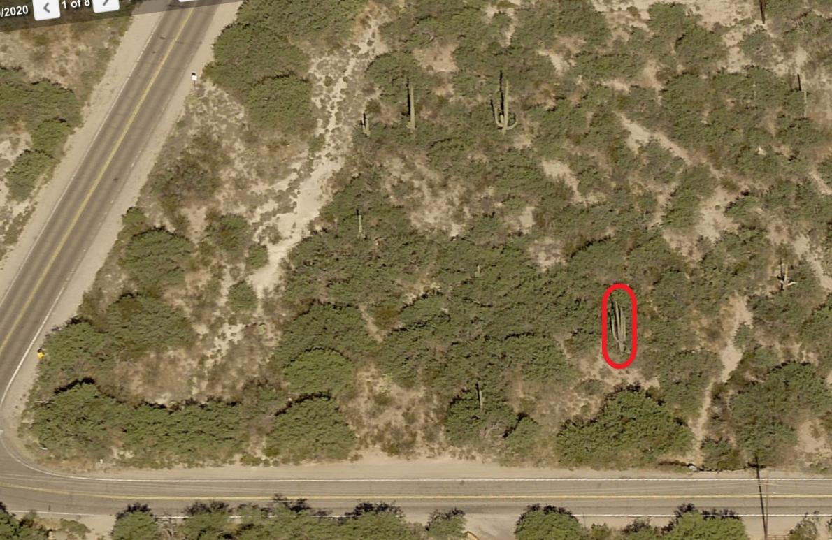
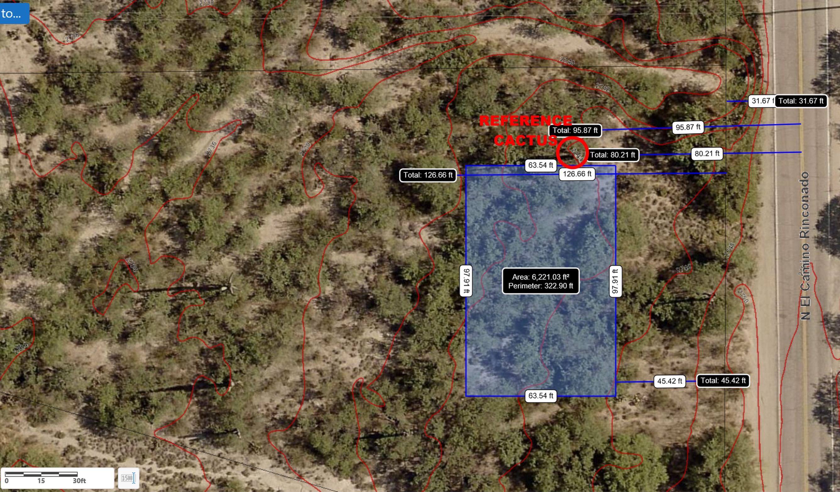
The County's GIS website, where I made this reference map, is very accurate: The right-of-way is 60-feet so it's 30-feet to the property
line. The reference Saguaro cactus (circled in red) is 97-feet from centerline of Rinconado. The North property line, which is also the
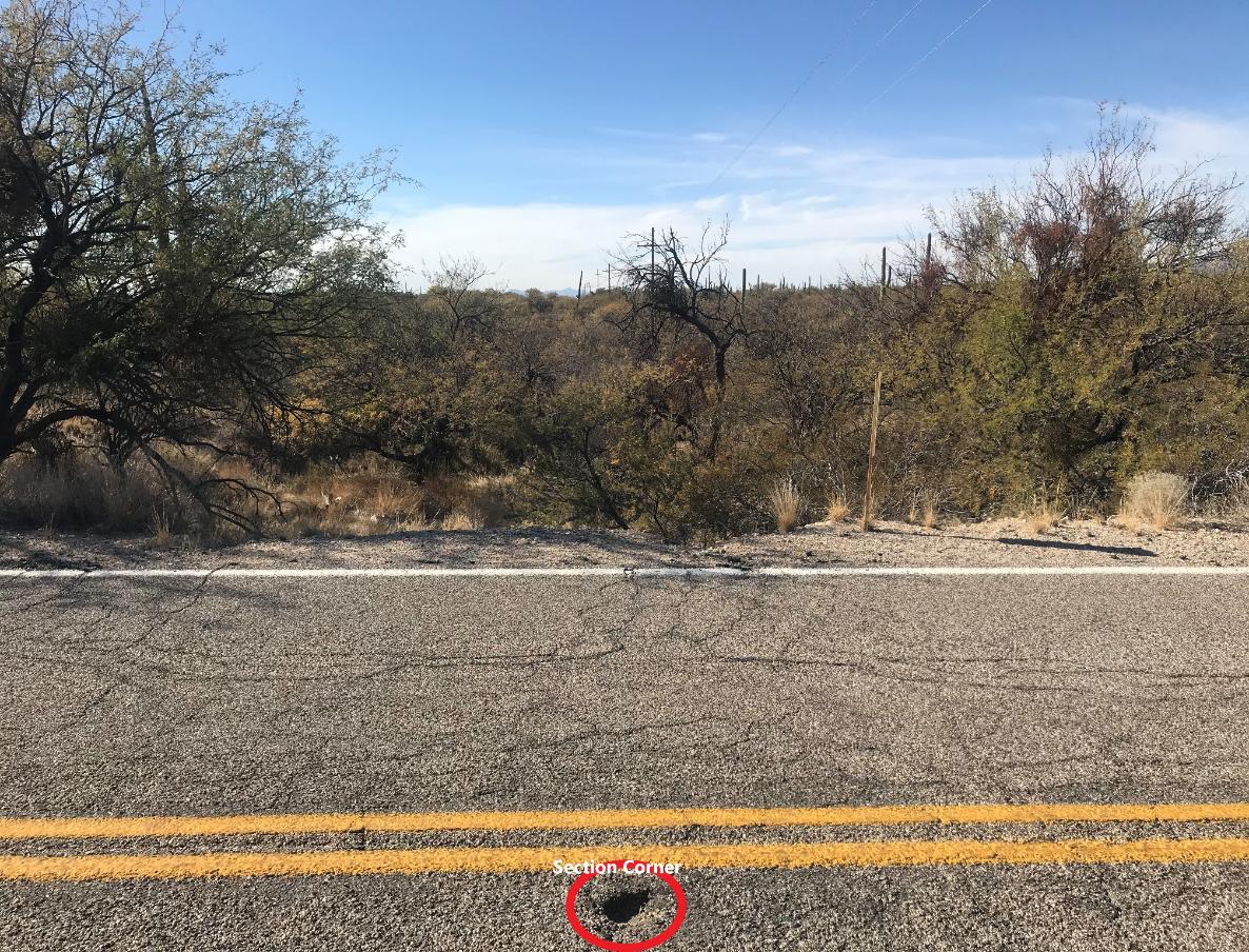
section line, is 23- feet south of the telephone poles/ wires at the very top of this survey. The Section corner is over the culvert at the
NE corner of my lot. Zoning requires a 50-foot setback on the east side, in front of house. 2-foot topographic elevations.
line. The reference Saguaro cactus (circled in red) is 97-feet from centerline of Rinconado. The North property line, which is also the
section line, is 23- feet south of the telephone poles/ wires at the very top of this survey. The Section corner is over the culvert at the
NE corner of my lot. Zoning requires a 50-foot setback on the east side, in front of house. 2-foot topographic elevations.
Reference Saguaro cactus. West view. NOTE a tiny bit of the culvert sticking out.
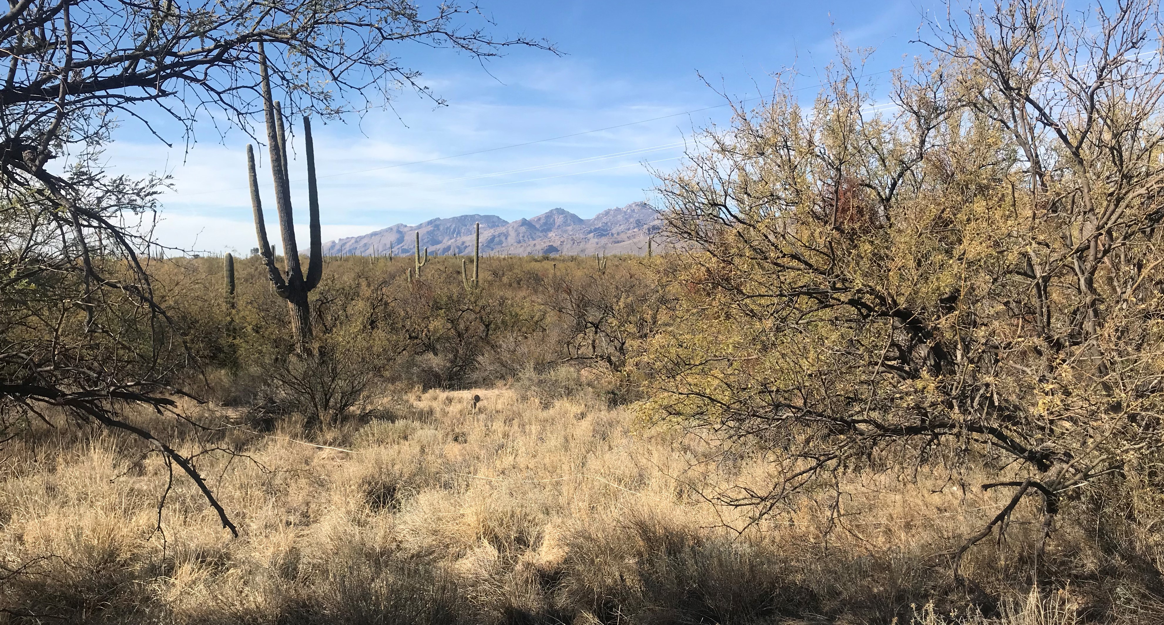
Reference Saguaro looking NW, note my measuring tape and lots of buffelgrass, a noxious weed.
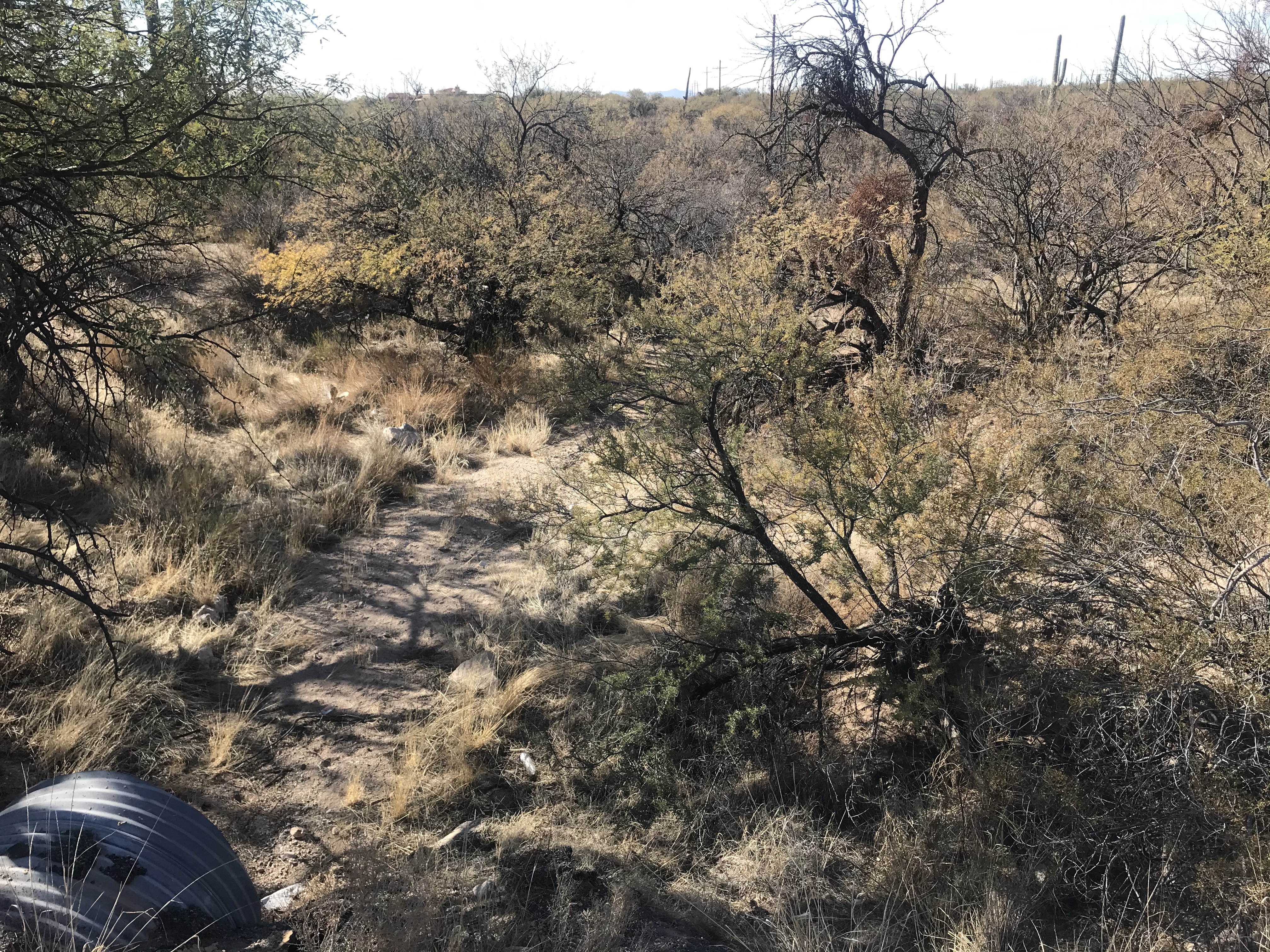
Culvert at NE corner of my lot
Section corner monument, underneath the road is the culvert
Culvert and Reference Saguaro
Reference Saguaro and tape measure

| The R/W Abandonment was approved by the Board of Supervisors and is now a part of the lot, which is now 2.97 acres More info about 2345 El Camino Rinconado |
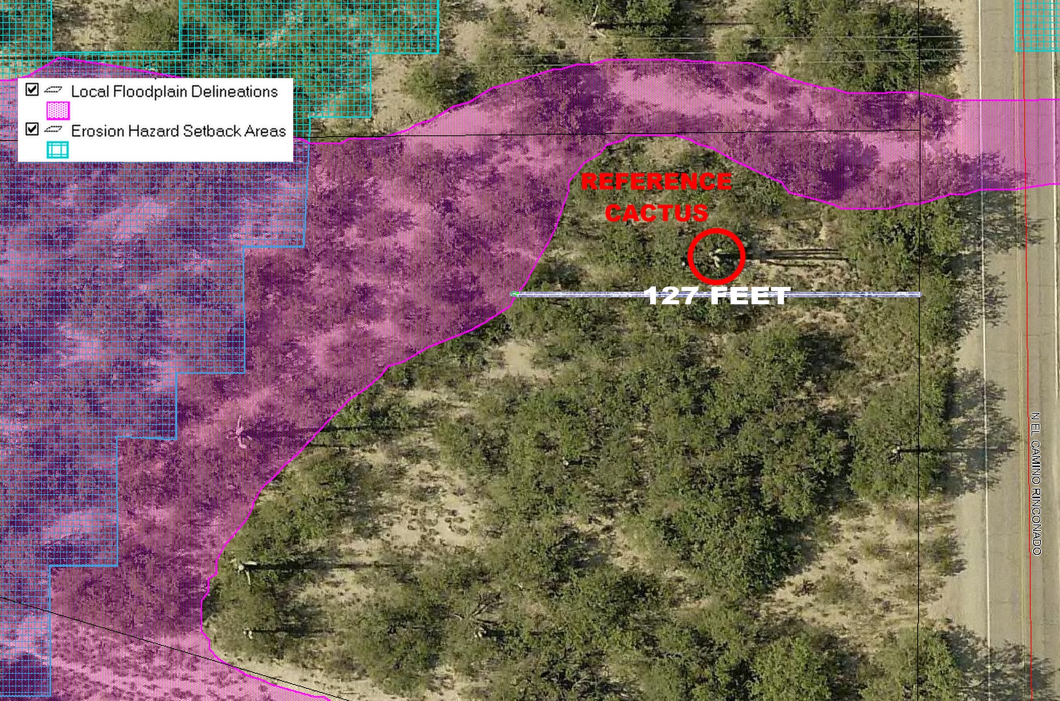
| 127-feet to the floodzone * Cactus is 267-feet from the centerline, perpendicular to Redington Road |
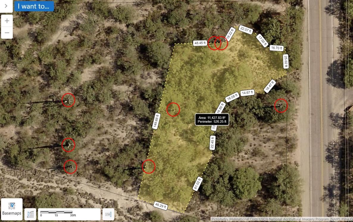
Riparian Habitat Disturbance of more than 1/3-AC (14520 sq ft) requires a mitigation permit: trimming trees and removing weeds
(buffelgrass) does not apply. (See also Code Section 16.30.40 and the La Cebadilla Estates HOA regulations for trimming trees,
removing buffelgrass, pack rat nests, mistletoe and dead branches.) Red circles show large Saguaro cactus, yellow area is where
house, septic (leach field) and driveway will be. Only a 44 x 44 foot area was partially cleared (of trees) for the house.
20 January 2021
17 January 2021
| The black dot is the reference cactus * Link to PDF with more detail |
| 25 February 2021 |
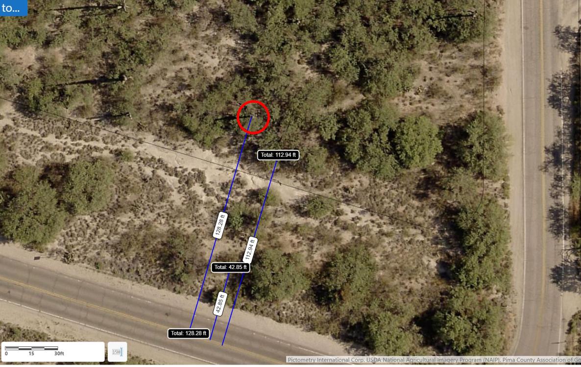
South boundary of the original lot is 113 feet from the centerline of Redington Road. The cactus is 128 feet from centerline. The additional R/W
Abandonment, which is not to be "disturbed" without permission, is 43 feet from centerline. Leach field can't go beyond 15 feet south of the cactus.
Abandonment, which is not to be "disturbed" without permission, is 43 feet from centerline. Leach field can't go beyond 15 feet south of the cactus.